Introduction: this is a short hike, suitable even for the smallest children, with no technical difficulty of any kind. Just three kilometres of route on the way out. In summer, because there may be tall grass, we recommend clothing that covers the little ones' legs. The best time is certainly spring. There is a chance to get children interested in the route by having them discover the way, which has a few points where the direction is uncertain, a game that spurs them to look at the land and understand it.
A delightful setting to walk even in the afternoon; in spring as well as in summer you can enjoy the wonderful view of the Corno Grande and, on days of the best visibility, you can even see the Adriatic Sea.
The hut lies in the Gran Sasso e Monti della Laga National Park.
Route description
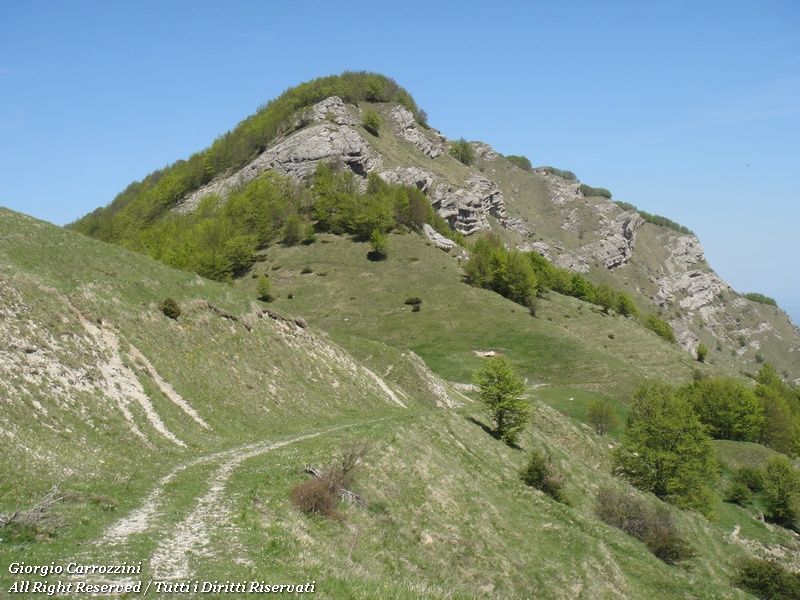
After the barrier the dirt road turns, if anything, into a grassy mule track. You carry on on foot, keeping below the long ridge of Cima Alta. Here the view is excellent: the Corno Grande and the Paretone dominate unchallenged. In spring the contrast of colours between the green of the lower vegetation the ridge of Cima Alta on our left.
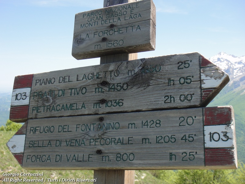
You carry on along the dirt road as far as the “Forchetta” (the little fork) that separates Cima Alta from the Montagnone.
It is here that the search for the hut gets more complicated. A sign shows the direction to take in an unclear way; instinctively you would be inclined to carry on beyond the forchetta along what seems to be the mule track. It is interesting, carrying on precisely along this stretch of the mule track, to look at the erosion shapes of the mountain.
The right way, instead, goes on from the forchetta back along the mule track that heads down, hard to see and signed even worse.
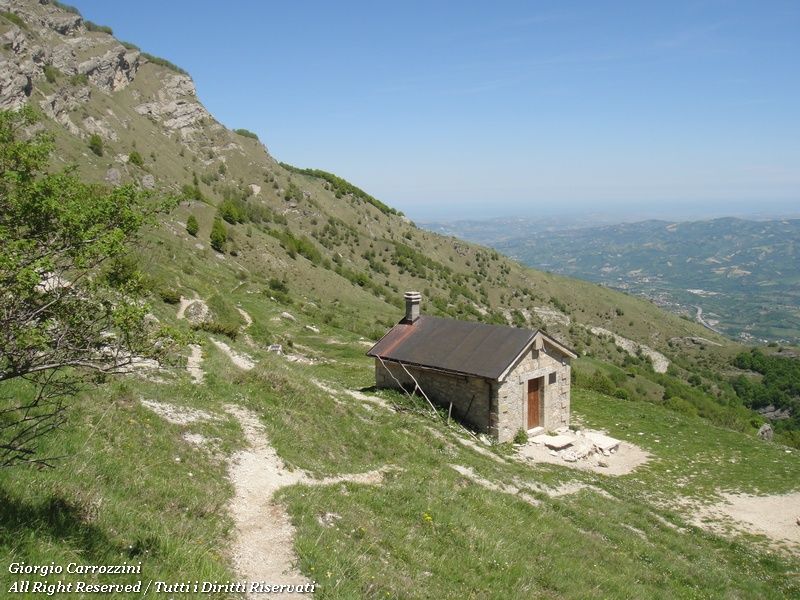
You go down in wide bends, following the track practically as far as the hut, which soon comes into view.
There are no particular hiking difficulties: it is a short route that runs mostly on mule track. One feature we noticed is the many landslips along the ridge of the mountain. These landslips seem to be due to the persistent presence of groundwater soaking the ridge of Cima Alta. Interesting indeed is the name of one place along the route: “vena fracida” (the rotten vein) gives the idea that here water has been a constant on this side of this hill.
The game you can play with children is precisely the search for the right path. At the Forchetta we ask them to tell us which is the right way. In theory they will all make the same mistake, while we know that to find the hut you have to read correctly the signage on the one hand and the traces of path on the other. Looking more closely at the forchetta, in fact, we notice the mule track that turns and goes down in the same direction we came from.
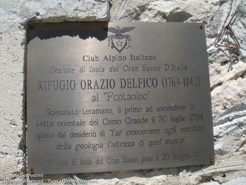
The way back is by the same route. The hut is closed, and is named after and dedicated to Marchese Orazio Delfico: from one of the oldest families of Teramo, he was the first to climb from the Teramo side to the summit of the Corno Grande (30 July 1974).
As often happened in the period in which he lived (the historical period of the Enlightenment), Delfico took the opportunity of this extraordinary conquest to make important measurements and collect a great deal of scientific data.
The hut is of course locked and seems in excellent condition; we found no information about the hut that would allow it to be used as a bivouac. A real shame that this little jewel of the Gran Sasso is so underused, when it could easily serve as a base for long treks or traverses on foot.
Variants and alternatives
You can shorten the return, when the children are old enough, by picking up a shortcut that follows path 103, which cuts straight up from the lower part of the mule track, a little way from the hut, to the Forchetta. From the forchetta the return is trivial and intuitive.
A second alternative is to climb Cima Alta directly from the forchetta, for just 200 metres of ascent, following the traces of path. From Cima Alta you then get back to the car park.
Notes on effort and difficulty
Visitor centres and accommodation
At Prati di Tivo there are bars and restaurants.
Frequently asked questions
At what age can you do the hike to the Rifugio del Fontanino?
The fact sheet already gives it for children aged 5-7: difficulty E- (CAI scale: E = hiking path, the - marks the easy end of the grade), about 170 metres of ascent and 2 hours 30 minutes in all. In summer it is better to dress the little ones in long trousers because of the tall grass.
Is the Rifugio del Fontanino easy to find?
Not entirely: at the Forchetta between Cima Alta and Montagnone the sign is unclear. The right way goes back along the mule track heading down, which is hard to see; from there you carry on to the hut, which soon comes into view.