During a long stay at San Martino di Castrozza I needed to get hold of the maps of the Pale di San Martino.
For inexperienced hikers, for those to whom the Dolomites are still unexplored territory, maps are an essential tool for starting to get familiar with the terrain. Using Google Earth is not useful at all, nor even remotely sufficient for getting to know the Dolomites; in fact this very useful software unfortunately offers an approximate graphic representation of these very complex mountains.
At the foot of the famous Pale I was able to compare three different 1:25,000 maps:
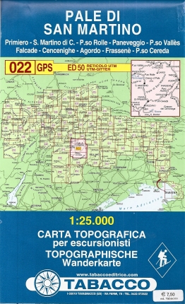
- the Tabacco topographic map for hikers;
- the Kompass hiking and ski-mountaineering map no. 76;
- the Meridiani Montagne Pale di San Martino 1:25,000 map.
All extremely useful, each for its own specific features. Let's look at strengths and weaknesses.
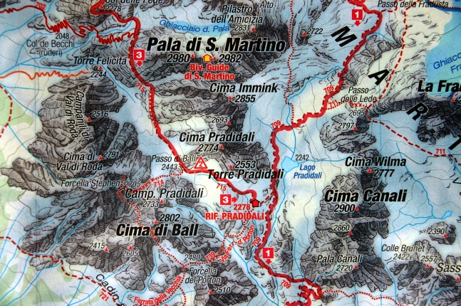
The Tabacco map is by far the best of the three.
For a start it is physically bigger at the same scale, so it undoubtedly covers a wider geographical area.
The colours used to show the relief are brighter and the contrasts sharper. In this case it is easier to identify the relief and the importance of the slopes and valleys.
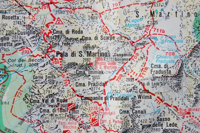
The symbols used to define the routes are similar to the other maps; in 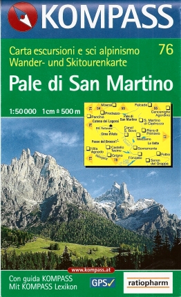 this sense, it uses a common language to identify via ferrata routes, routes, paths and ski-mountaineering itineraries. If you know the map symbols there is no chance of confusion between different symbol systems. The choice of typeface for the names of municipalities, villages and towns is pleasant and doesn't annoyingly overlap the other graphic elements of the map. The path network is very precise and there are no approximations of the path, which is easy to identify. (Mark 8/10)
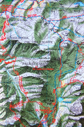
The Kompass map has less lively colours; the publisher gave more prominence to place-name information, making the map crowded with too much information at the expense of the view at a glance.
The relief is hard to identify. While on the one hand the place names are rich in information, on the other hand it is complicated, if not impossible, to see the presence of the mountains at a single glance. Let us remember that we are talking about hiking maps for the mountains, and this would surely be the main feature to give importance to.
The symbols are similar to those of the Tabacco maps; evidently both publishers follow a chosen communication standard that turns out to be a winner for both of them. In the case of Kompass the paths are less precise: in some stretches where a presumed path with tight zigzags is shown, the route line is only sketched, soft and approximate. (Mark 6/10)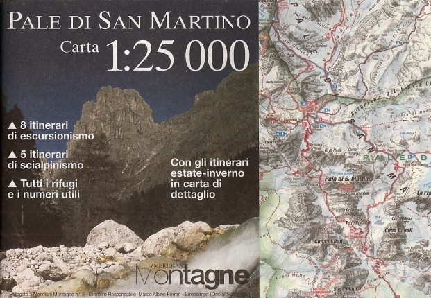 The Meridiani Montagne map (which comes with the magazine issue devoted to the Pale di San Martino) has many strengths. The publisher has
put a great deal of work into identifying the relief, with a very decisive ink line of strongly descriptive character. The use of colours is good too, not too bright but clear and very illustrative. You quickly identify the most forbidding peaks of the Pale di San Martino, which more than any other mountain have deeply scored and extremely steep sides.
The path network is approximate, much as in the Kompass maps. In addition, the back of the map shows individual routes in specific areas of the Pale di San Martino park. These itineraries are a novelty compared with the other two maps too, encouraging hikers to explore these mountains with unconventional itineraries.
In this last map too, the choice of typefaces for the place names is more balanced and less invasive compared with the other graphic elements, greatly improving its legibility. (Mark 7/10)
To hikers we suggest buying the first two, although a cross-comparison of all three certainly gives a more in-depth view of the terrain. Lastly, it should be remembered that here, more than in other mountains, you need to make a direct comparison between topographic map and terrain in order to know precisely the hiking possibilities of this marvellous mountain group, one of the most beautiful in the world.
|
Kompass map
|
Tabacco map
|
Meridiani Montagne map
|
Fact sheet
- Title
- Not available
- Author
- Not available
- Publisher
- Not available
- ISBN
- Not available
- Pages
- Not available
- Photos and illustrations
- None
- Year first published
- Not available
- Price (euros)
- Not available